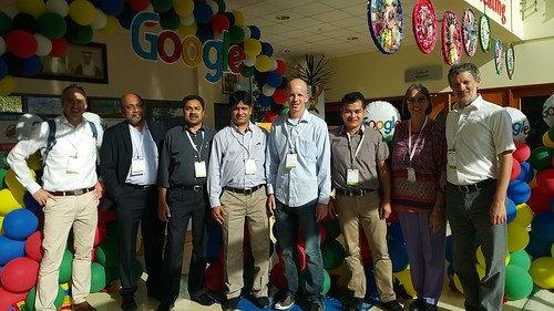
 A couple days late, but I had to share what I learned at the Google Apps for Education Summit, Day 2. I loved this conference with so many people from so many schools and places!
I was looking forward to the second day, even though my thoughts were with the Accreditation Steering Committee team from my school, which also met today. I had to miss it, but I was not disappointed to be at the Google Summit!
Ben Friesen‘s keynote was as captivating as yesterday’s by Mark! It was so inspiring. It just made me want to keep on creating, annotating and sharing.
The first breakout session, however, was a disappointment. Really, I should learn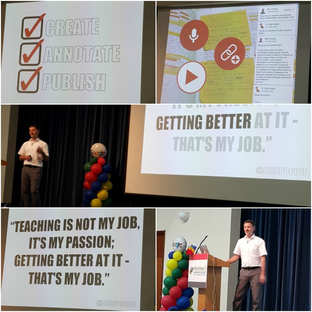 to just not take a chance on vendor sessions. I was sitting in the front row, excited to learn how to use the reading and writing app I had downloaded the night before. However, then I learned that we have to buy a license to use it. I guess the version on my computer is a 30-day trial. I wasn’t enamored enough with the demo to even want to buy it.
The next two sessions I attended were by our keynote speaker–Ben Friesen. One session was using Google Drawings and the other My Maps.
In the first session, we worked on a collaborative drawing of the 1980’s with Ben. It was fun, and, if you click, you can see the messiness of large group collaboration. Then he demonstrated some of the features we can use. A few new features I learned:
- There is a red snap-to grid to mark the center of the canvas. That is handy.
- You can connect box lines to group the boxes in a graphic organizer. That way if you need to move the box, the line comes along with it.
- You can customize the size of the canvas to fit the project you need. Go to File–Page setup. For instance, if the limit of the header size is 800 x 200 pixels, you make your canvas that size and create it just the right size. No need to crop or fit in later when it’s uploaded.
Finally we worked on our own header for a Google Classroom, which I won’t be using for a while until our students get their own GAFE email addresses assigned. Next on my wish list.
The session I looked most forward to was using My Maps. I love maps and, I really wanted to see how Ben so cleverly compared the true size of Greenland (2.17 sq km) with Saudi Arabia (2.15 sq km) in the Demo Slam on Friday. You would never know these two countries were so similar in size if you use the all too-popular Mercator projection.
I majored in geography in college, largely because of my love for maps. In this session, it was exciting to see the great transformation over the past few years in what Google has done with their map programs. I hadn’t been paying attention!
I used to make maps showing where the participants were from in the Global Read Aloud and other experiences. I still used Maps and Forms, but it was more difficult importing my data with third party applications that most of the time I didn’t understand. Nowadays, My Maps skips the middleman! Excellent. We each easily used the same data to work on our map of places we wanted to take a virtual field trip, manipulating the data during this session. In my map you can see different colors for all the teachers who shared their Twitter handle. Ben’s was a far better and more productive presentation than one I made several years ago when mapping our connections. (If you visit that link, I’m sorry to say you’ll find that some of the links to my maps have been lost into some unknown digital graveyard.) Ben also shared two warm-up mapping games for kids and adults–GeoGuessr and Smarty Pins. Very fun!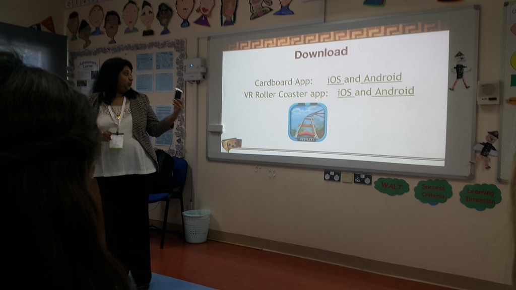
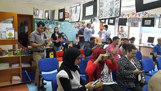
During the last session, I had fun using the virtual reality glasses and apps with Shina in the Google Cardboard session. Amazing! Shina is a geeky technology coach in Saudi Arabia. (And my new friend. She is the first person I met Friday morning at breakfast.) She is also the journalism teacher for her district. Her students make the yearbook for the school, and she helps them use new technologies to make a physical book more interactive. Last year’s book had tons of examples of augmented and virtual reality for readers to access in order to enhance the book. One example was a 360-degree photo sphere of the old campus they vacated last year, so it will always be available as a memory to students.
 Speaking of photo spheres (Not that photosphere, Astronomers!), I took my first 360 degree photo in our meeting room at St. Christopher’s School while we waited for the last keynote to start. (Again, I was reminded of all the wide world of learning, creating, and producing we can do with just an Android device! So many things we don’t even know about, YET.) I’ll be ordering some Google Cardboard glasses ASAP!
Finally, Chrystal Hoe did a nice job wrapping up with the session with another keynote address. I loved the video she showed about Erno Rubrik about the importance of asking questions to make amazing things happen!
Check out the schedule to see what other sessions there were.
I’d like to make a challenge to my new friend, Asma, who I enjoyed tweeting with and meeting at the Google Summit. I hope to read on your new blog what you learned last weekend!